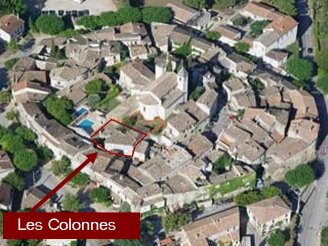
Les Colonnes
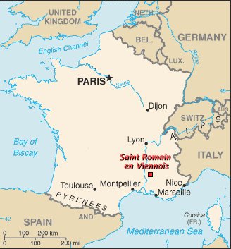
Saint Romain en Viennois
|
|
Les ColonnesSaint Romain en Viennois |
|
|
||||||||||||||||||||||||||||||
|
Location Les Colonnes is located in the centre of of Saint Romain en Viennois on the village's one internal "ring road". Just outside the village, the Promenade d'Hiver forms an external ring road, often used in the summer for open air markets.
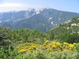
Saint Romain en Viennois is located in the south-eastern part of France in the Vaucluse region of Provence, very near the border with the Drôme Provençale to the north. This is an area of substantial hills, dense with pines and truffle oaks, overlooked by 1900 metre high Mont Ventoux (see photo above). To the east are the pre-Alps; to the west is the flat vine and fruit-tree covered Rhône Valley. The GPS co-ordinates are: 44° 15' 29" N 5° 6' 36" E It's easily reached:
|
||||||||||||||||||||||||||||||
Last update: 26 December, 2011